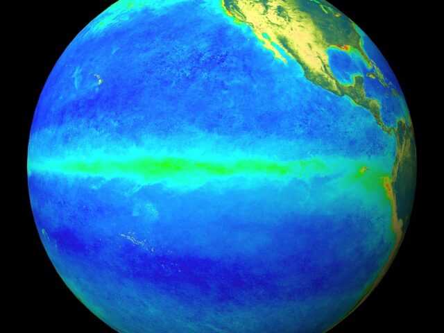
MELBOURNE, Australia – Indicators of the El Niño–Southern Oscillation (ENSO), including tropical Pacific sea surface temperatures (SSTs), cloud, wind, and pressure patterns are consistent with El Niño conditions, reports the Bureau of Meteorology of the Australian Government
Climate model forecasts indicate some further warming of central to eastern Pacific SSTs is possible, with SSTs remaining above El Niño thresholds early into the second quarter of 2024.
The influence of El Niño on Australian rainfall usually reduces during summer, especially in the east; however, below median rainfall is still often observed in north-east Australia. Additionally, high-impact rainfall events can occur during El Niño years, particularly during October to April when severe storm frequency peaks.
The positive Indian Ocean Dipole (IOD) event continues. IOD index values have eased from their highest values in October and are unlikely to re-strengthen, meaning the positive IOD event is likely past its peak. All international climate models surveyed by the Bureau suggest the positive IOD is likely to ease in December.
The Southern Annular Mode (SAM) index is currently neutral. Forecasts suggest it is likely to remain mostly neutral over the coming fortnight. A neutral SAM has limited influence on Australian climate.
A moderate to strong Madden–Julian Oscillation (MJO) pulse is currently over the Maritime Continent. International climate models suggest it will move across the Maritime Continent and into the western Pacific over the coming fortnight. When the MJO is over the Maritime Continent, it typically increases rainfall over parts of northern and central Australia.
Global warming continues to influence Australian and global climate. Global sea surface temperatures (SSTs) were highest on record for their respective months during April to November. Forecast unusually warm sea surface temperatures (SSTs) in the Tasman Sea may also be contributing to a chance of above median summer rainfall over parts of Australia.
Australia’s climate has warmed by 1.48 ± 0.23 °C since national records began in 1910. There has been an increase in extreme heat and fire weather associated with the warming. There has also been a trend towards a greater proportion of rainfall from high intensity, short duration rainfall events, especially across northern Australia.
The Bureau’s climate model includes all influences on Australian climate when generating its forecasts, including the influence of climate change.


