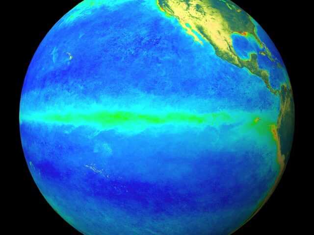
Strong El Niño conditions were established across the Equatorial Pacific during September 2015. Sea surface temperature anomalies in the central and eastern Pacific remain close to or exceed the +2oC mark.
The atmosphere is strongly coupled to these ocean anomalies. The Southern Oscillation Index was -1.7 for September 2015 [value estimated the 29th of September] indicating consolidation of air pressure differences between Tahiti and Darwin.
Further, strong pulses of westerly wind anomalies (weaker trade-winds) have affected the central and western equatorial Pacific since August.
Consistent with these patterns, convection and rainfall were suppressed over Indonesia and large parts of the Maritime Continent, while enhanced convective activity and rainfall were observed in the central and eastern Equatorial Pacific.
International guidance indicates that El Niño is virtually certain (99% chance) to continue over the next three months. By many measures, the current event is tracking close to the 1997/98 El Niño (the strongest since 1950), and is expected to intensify further over the next 3 months.
For October – December 2015, above normal pressure is forecast to the north and west of New Zealand, while below normal pressure is expected to the east and south of the country.
This circulation pattern is likely to be accompanied by anomalous southwesterly wind flows – a signature of El Niño conditions.
Sea surface temperatures (SSTs) for the remainder of the calendar year are forecast to be normal or below normal along the west coast of the country, while SSTs are expected to be in the below normal range to the east of New Zealand.
Outlook Summary
October – December 2015 temperatures are about equally likely to be near average (40% chance) or below average (40-45% chance) for all regions of New Zealand. Cold snaps and frosts can still be expected from time to time in spring in some parts of the country.
October – December 2015 rainfall is about equally likely to be in the near normal (40% chance) or below normal (40-45% chance) ranges in the north and east of the North Island, and about equally likely to be in the near normal (35% chance) or below normal (40% chance) ranges in the north of the South Island.
Near normal rainfall is the most likely outcome (45% chance) for the west of the North Island. Seasonal rainfall in the west of the South Island is about equally likely to be in the near normal (40% chance) or above normal (35% chance) ranges.
October – December 2015 soil moisture levels are most likely to be near normal (40% chance) or below normal (35% chance) in the north and east of North Island. In the east of the South Island, soil moisture levels are equally likely to be near normal (40% chance) or below normal (40% chance).
In the western regions of both Islands as well as the north of the South Island, soil moisture levels are most likely to be in the near normal range (40 or 45% chance).
October – December 2015 river flows are most likely to be in the near normal range (45% chance) for all of the North Island as well as west of the South Island. River flows are about equally likely to be in the near normal (40% chance) or below normal (40-45% chance) ranges for the north and east of the South Island.
Full document: Seasonal_Climate_Outlook_October2015_Final.pdf


