ACCRA, Ghana — SAT4Farming, an initiative to reach thousands of small-scale cocoa producers with information and services to improve their productivity and sustainability, was announced today.
It is designed to use digital technology and satellite imagery to create individual Farm Development Plans (FDPs) that guide farmers over a seven-year period.
The digital FDPs provide a planning and monitoring tool, available over mobile devices. Advice on farm practices and investments, climate-adaptation, certification training, and ongoing monitoring provide farmers and field agents with unprecedented data-based guidance to a more sustainable future.
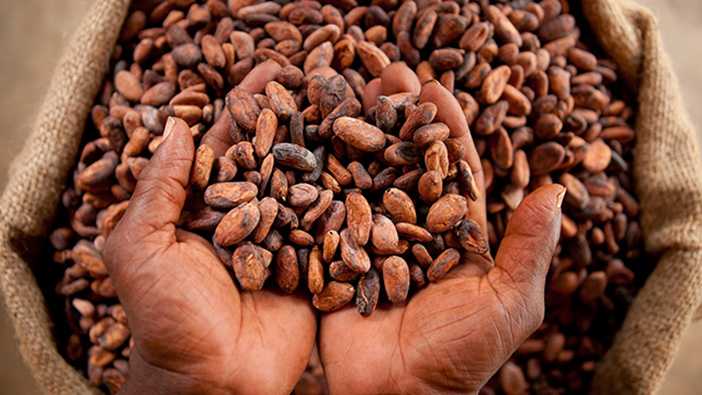
Smallholder farmers produce the vast majority of the world’s cocoa, the basic ingredient for chocolate. Cocoa farmers face declining yields, mounting threats from pests and disease, and persistent poverty.
In addition, farmers rarely get the timely training and advice they need to change their circumstances. In Ghana, 800,000 smallholder farmers make the country the world’s second largest cocoa producer.
SAT4Farming partners include the global nonprofits the Rainforest Alliance and Grameen Foundation; global cocoa trader Touton; the University of Ghana’s Department of Agricultural Economics and Agribusiness; the Netherlands-based Satelligence and WaterWatch Projects.
With the launch, Touton has begun deploying the SAT4Farming digital FDP among its network of farmers and suppliers for Mars, Inc., one of the world’s largest chocolate makers. Meanwhile, Mars suppliers across a number of countries are adopting similar approaches to support a more sustainable cocoa sector by improving smallholders’ livelihoods and protecting the environment. COCOBOD fully supports the program implementation in Ghana.
SAT4Farming builds on a pilot in Indonesia where Mars, the Rainforest Alliance and Grameen Foundation partnered to create the digital FDP. It is based on a specialized agronomic model for cocoa that includes digital certification performance information. In Ghana, the integration of satellite imagery is expected to streamline the process of creating an FDP, facilitate monitoring, and provide greater insights into dynamic environmental conditions.
Initial funding comes from the Geodata for Agriculture and Water (G4AW) program of the Netherlands Space Office (NSO). The program plans to launch a social enterprise that will make SAT4Farming services widely available and ensure the economic sustainability of the work.


