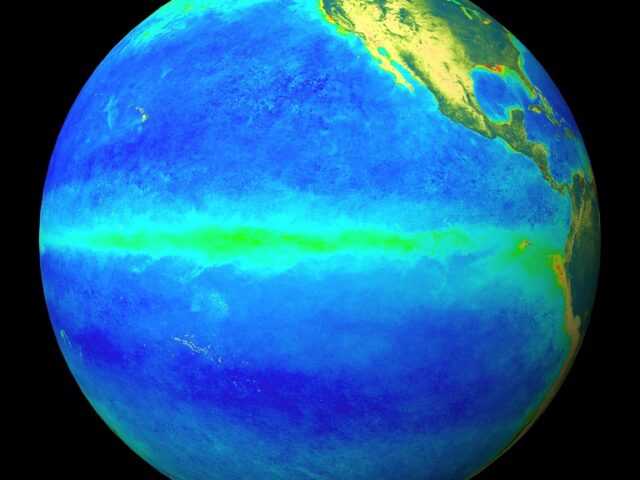
MELBOURNE, Australia – An El Niño and a positive IOD are underway. According to the latest Climate Driver Update releasded by the Bureaus of Meteorology of the Australian Government, oceanic indicators firmly exhibit an El Niño state. Central and eastern Pacific sea surface temperatures (SSTs) continue to exceed El Niño thresholds. Models indicate further warming of the central to eastern Pacific is likely.
Broadscale pressure and cloud patterns over the Pacific reflect El Niño. Trade wind strength over the past fortnight has been weaker than average in the western Pacific but is close to normal elsewhere.
Overall, there are signs that the atmosphere is responding to the warm SSTs over the Pacific and coupling of ocean and atmosphere is occurring. This coupling is a characteristic of an El Niño event and is what strengthens and sustains an event for an extended period. El Niño typically leads to reduced spring rainfall for eastern Australia.
Climate models indicate this phenomenon is likely to persist until at least the end of February. El Niño typically leads to reduced spring and early summer rainfall for eastern Australia, and warmer days for the southern two-thirds of the country.
The positive Indian Ocean Dipole (IOD) continues to strengthen. The IOD index is +1.85 °C for the week ending 8 October. This is the sixth-highest weekly IOD index value since records for the Bureau SST dataset began in 2001, with all higher index values observed during the positive IOD of 2019. All models predict this positive IOD is likely to continue into at least December. A positive IOD typically leads to reduced spring rainfall for central and south-east Australia.
When a positive IOD and El Niño occur together, their drying effect is typically stronger and more widespread across Australia.
The Madden–Julian Oscillation (MJO) is currently weak, with some surveyed models forecasting a pulse to develop around the Western Pacific or Western Hemisphere regions during the next fortnight.
The Southern Annular Mode (SAM) index is currently neutral with forecasts indicating it will remain neutral over the coming fortnight.
The long-range forecast for Australia indicates warmer than average conditions are likely across most of Australia from November to January and below median rainfall for much of western, northern and southern Australia. The Bureau’s climate model takes into account all influences from the oceans and atmosphere when generating its long-range forecasts.


