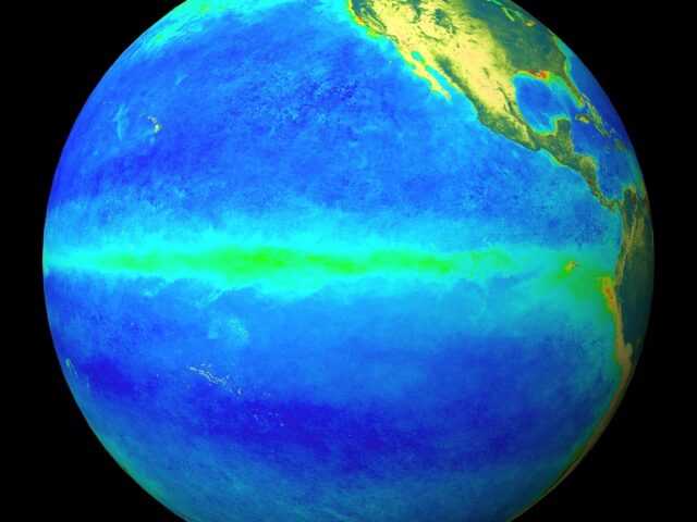
MELBOURNE, Australia – Oceanic indicators exhibit a clear El Niño state. Central and eastern Pacific sea surface temperatures (SSTs) continue to exceed El Niño thresholds, with warmer than average waters beneath the surface supporting the warmth at the surface, according to the most recent Climate Driver Update from the Bureau of Meteorology of the Austalian Government.
Models indicate some further warming of central to eastern Pacific SSTs is likely, with SSTs remaining above El Niño thresholds into the early southern hemisphere autumn 2024.
Broadscale pressure and cloudiness patterns over the Pacific reflect El Niño. Trade wind strength over the past fortnight has been weaker than average over most of the Pacific.
El Niño typically leads to reduced spring and early summer rainfall for eastern Australia, and warmer days for the southern two-thirds of the country.
A positive Indian Ocean Dipole (IOD) is underway. All models indicate that this positive IOD will likely be sustained to at least December. A positive IOD typically leads to reduced spring rainfall for central and south-east Australia and can increase the drying influence of El Niño.
When a positive IOD and El Niño occur together, their drying effect is typically stronger and more widespread across Australia.
The Madden–Julian Oscillation (MJO) is currently weak. Most surveyed models indicate it will strengthen in the coming week. However, there is disagreement between models regarding the location of the pulse. Some models suggest the Western Pacific while others forecast development of the MJO over the eastern Pacific or tropical Americas regions.
The Southern Annular Mode (SAM) index is currently neutral with forecasts indicating it will remain mostly neutral over the coming fortnight.
The long-range forecast for Australia indicates warmer than average conditions are likely across Australia from November to January with below average rainfall across much of Australia excluding parts of the southeast. The Bureau’s climate model takes into account all influences from the oceans and atmosphere when generating its long-range forecasts.


