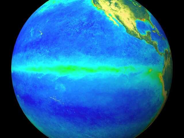
MELBOURNE, Australia – The El Niño Alert of the Bureau of Meteorology of the Australian Government continues, with El Niño development considered likely in the coming weeks, despite the current lack of atmospheric response. When El Niño Alert criteria have been met in the past, an El Niño event has developed around 70% of the time.
Sea surface temperatures (SSTs) in the tropical Pacific are exceeding El Niño thresholds, with climate models indicating this is likely to continue at least through to the end of the year. In the atmosphere, however, wind, cloud and broad-scale pressure patterns mostly continue to reflect neutral ENSO conditions.
This means the Pacific Ocean and atmosphere have yet to become fully coupled, as occurs during El Niño events. El Niño typically suppresses winter–spring rainfall in eastern Australia.
The Indian Ocean Dipole (IOD) is currently neutral. Climate model forecasts suggest a positive IOD is likely to develop in late winter or early spring. A positive IOD typically decreases winter–spring rainfall for much of Australia, and can exacerbate the drying influence from El Niño.
The Madden–Julian Oscillation (MJO) is currently weak, with most climate models surveyed indicating no significant strengthening of the MJO in the next two weeks.
The Southern Annular Mode (SAM) index is currently positive and is expected to return to neutral values in the coming week. A neutral SAM has little influence away from normal on Australian climate.
The current status of the ENSO Outlook and other climate drivers does not change the long-range forecast of warmer and drier conditions across much of Australia for August to October. The Bureau’s climate model takes into account all influences from the oceans and atmosphere when generating its long-range forecasts.


